Case Study in Brief
Description
This activity is based on exploring forms of multimodal documentation – using multiple approaches to record and to integrate different kinds of sensory dimensions – that expand the practice of mapping in a creative and collaborative way. The activity starts from the idea of an archipelago of imaginary islands that have never been populated by humans or have been abandoned by their inhabitants. Participants carry out a sensory research process that contributes to the production of knowledge about each of these rediscovered islands.
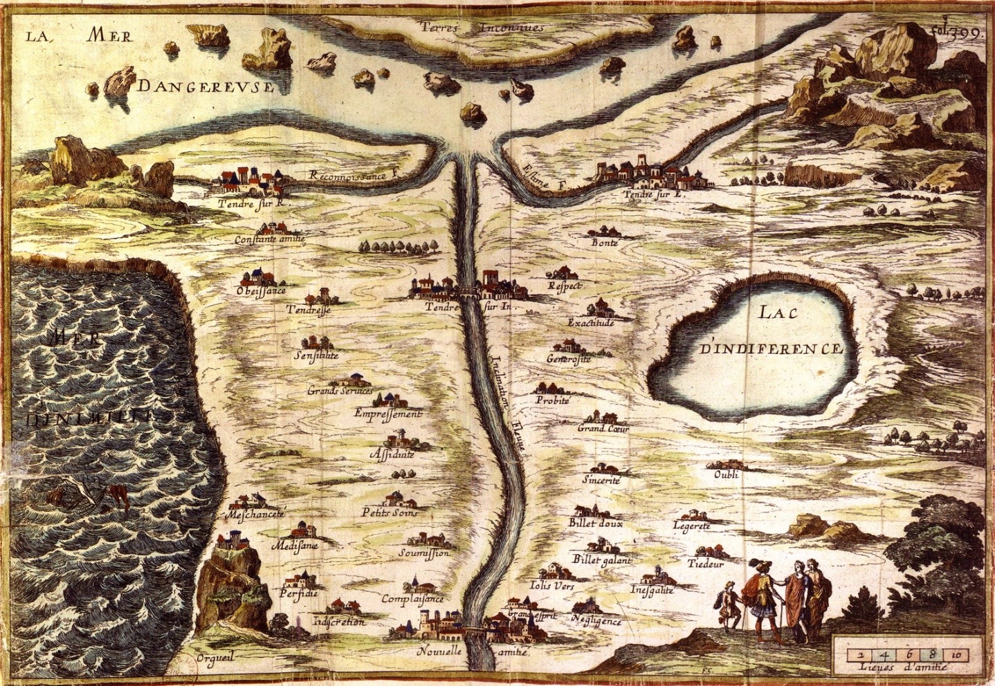
This workshop is inspired by the tradition of imaginary maps in art and literature (for example, the 17th-century ‘Carte du Tendre’). Participants start from the geographical notion of an island as a limited territory and renew imaginaries historically associated with it. Participants are organised into groups that work from a type of archival source (a written description, photographs, drawings, a sound archive or raw material) provided by the facilitator. From this fragment, participants must reconstruct other aspects of the island that they are responsible for documenting and mapping.
Dispatch From the Field
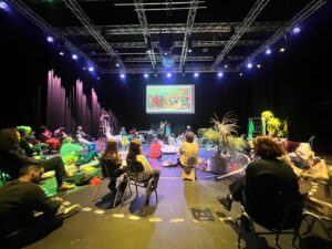
1. Introduction* and presentation of references
We facilitators show a selection of references to historical maps and invented or imaginary maps. We then launched a discussion based on different questions:
- How are maps made?
- What different types of maps exist?
- What other types of maps can you imagine?
- What kind of materials or files are needed to make a map?
- Can you make a map of a place without having been there?
We then present the fictional framework: the participants are researchers rediscovering the islands of a lost archipelago. Their task is to reconstruct and document one of these islands based on the two document fragments they have been assigned. Participants have to imagine the different characteristics of the island they are responsible for. We emphasise collaborative interpretation, imaginative reconstruction and sensory exploration.
* The introduction can be adapted to suit different storytelling styles—ranging from scientific and serious to playful and imaginative—depending on the facilitator’s approach.
Participants are organised into groups of 3 or 4 people.
2. Distribution of archive materials:
Each group of participants is given two archive fragments belonging to the island they are to research.
3. Sensory research and reconstruction of the island
Each group takes the time to observe and interpret the fragment they have been assigned. Depending on the different types of archives, they are encouraged to ask themselves:
- What kind of landscape might the island have? And what kind of climate?
- What different living beings could inhabit this place? What would the vegetation or its orography be like?
- What sounds characterise this island?
- What stories might have taken place on this island? Have these events left traces on the island landscape?
- What kind of activities did its inhabitants engage in? etc.
How participants answer these questions then determine the characteristics of the island, and they create different fictional archives through multimodal documentation practices – these practices include:
- making sound recordings,
- taking photographs,
- taking notes,
- making videos,
- and drawing or collecting materials from real elements present in their environment.
These documenting practices can be carried out in the different spaces surrounding the main activity space, including indoors and outdoors.
4. Creation of a multimodal map of each island
The aim of this activity is to go beyond the idea of a map as a representation of a territory and encourage the creation of multimodal maps, i.e. maps that integrate different types of data and, in this case, can integrate different kinds of sensory dimensions beyond visual data. Sound maps, texture maps, emotional maps, object maps or colour maps can be created to represent the identity of a place in a different way. The maps can focus on one of these aspects or combine several of them.
The first phase is devoted to group reflection to agree on the strategy for creating each map, based on the materials collected. Using large sheets of paper and a variety of materials (the initial files, the fabricated files, drawing materials, collage materials, found objects or sound recordings), the groups create multimodal maps to represent the most characteristic aspects of their island. These maps may include: topographical representations, imaginary flora or fauna, cultural or ritual elements, soundscapes, etc.
5. Sharing the archipelago
Once participants in their groups have made theirmaps of the different islands, they share them with the full group. Each group presents its island to the others, sharing both its sensory discoveries and the imaginary narrative it has developed from the archival remains. The maps are placed together on the floor or on the wall, and participants suggest how their islands could be connected or related to each other, whether through ocean currents, migratory birds, shared myths or other means. The result may be a co-created metamap of the entire archipelago.
6. Reflection and discussion
The session concludes with a reflection: What have we learned from sensory mapping? How has the archival fragment guided us in our interpretation? What type of knowledge becomes visible through creative mapping?
Some optional topics for further reflection are colonial mapping practices, the politics of naming and knowing, and non-Western cartographic traditions.
Practical Details – Facilitator’s Notes
How did you modify the activity?
This activity can last between 1.5 and 3 hours and can be carried out in one go or in two consecutive sessions.
It is loosely based on the Mapping the Unknown activity but does not use robots and focuses on multimodal documentation practices.
How did you organize the space?
The workshop space combines a well-lit interior that includes a large work area divided into zones for the different groups, with different outdoors or indoors spaces that are accessible for carrying out the documentation practices.
Who did you work with?
This activity was with children aged between 10 and 14, with adjustments made depending on the varying abilities and skills within this age range.
What resources did you use?
We prepared in advance different “archival fragments” of different kinds: written fragments (e.g. field notes, fictional letters, poems), photographs, drawings, sound recordings (ambient sounds, strange noises, spoken words, songs), raw materials (minerals, sand, etc.) and objects
For the documentation phase: Mobile phones with photo and sound recording capabilities / Bags for collecting samples/ Notebooks and pens for taking notes.
For making maps: A3 sheets of paper, drawing materials (graphite pencils, coloured pencils, felt-tip pens, etc.), images for making collages, different types of paper (tracing paper, metallic paper, coloured paper), glue/cello tape, scissors and if possible, model elements, black and white or colour printer (to print images taken by participants).
What did you learn?
The workshop invites participants to explore how imaginative frameworks and sensory experimentation can open up new avenues of inquiry.
Working with fictional archives and creative stimuli allows participants to imagine different modes of research and generate collaborative knowledge, rethinking conventional approaches to cartographic production through other artistic and creative modalities.
The use of diverse materials and multimodal documentation supports alternative forms of knowledge based on observation, speculation, and storytelling.
These methods highlight the value of questioning as a form of research, in which understanding emerges through interpretation and dialogue. The workshop aims to highlight how cartography can be a critical and inclusive practice that combines curiosity, creativity, and reflection.